
In our October 2017 issue, RJ Andrews and Howard Wainer imagine a collaboration between two data-storytellers of the past, W. E. B. Du Bois and C. J. Minard. The result of this gedanken-collaboration is a series of maps charting the relocation of African-Americans from the southern United States in the century after their emancipation from slavery.
Andrews and Wainer write that: “Between 1916 and 1970 more than 6 million [African-Americans] migrated to the industrial North and West. Historians like Nicholas Lemann have dubbed this ‘the Great Migration’, commemorating it as the largest peacetime movement of people within a country in history.”
The maps from the article are reproduced below. Subscribers can read the full article in print or online (RSS and ASA members must first login to the members-only area of their society’s website – rss.org.uk or amstat.org – and head to the publications section).
- Update, 17 October: The article has been made free to read online until mid-November.
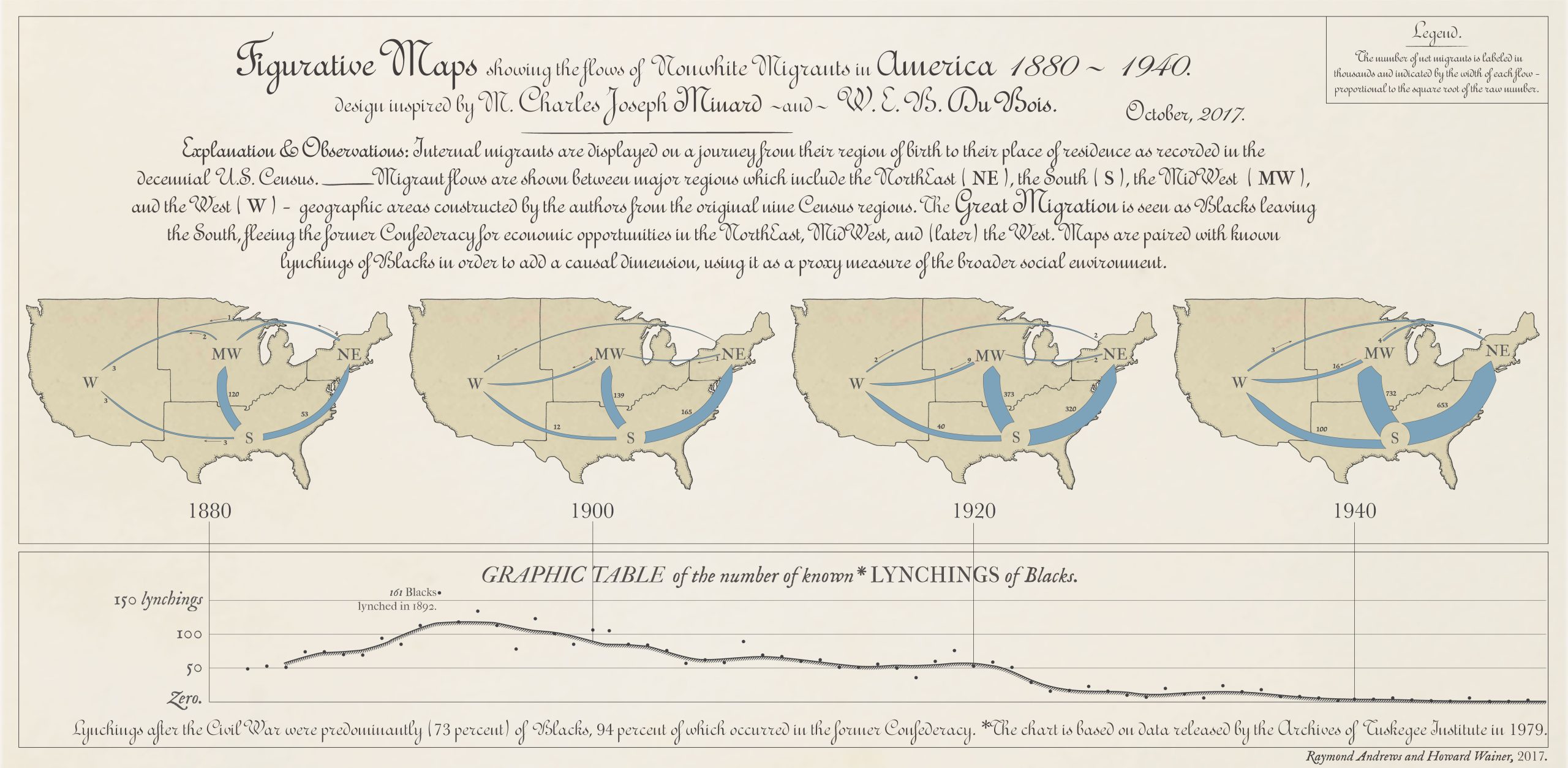
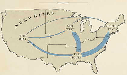
ABOVE Figurative maps by the authors showing the flows of non-white migrants in America, 1880-1940, using a design inspired by Minard and Du Bois.
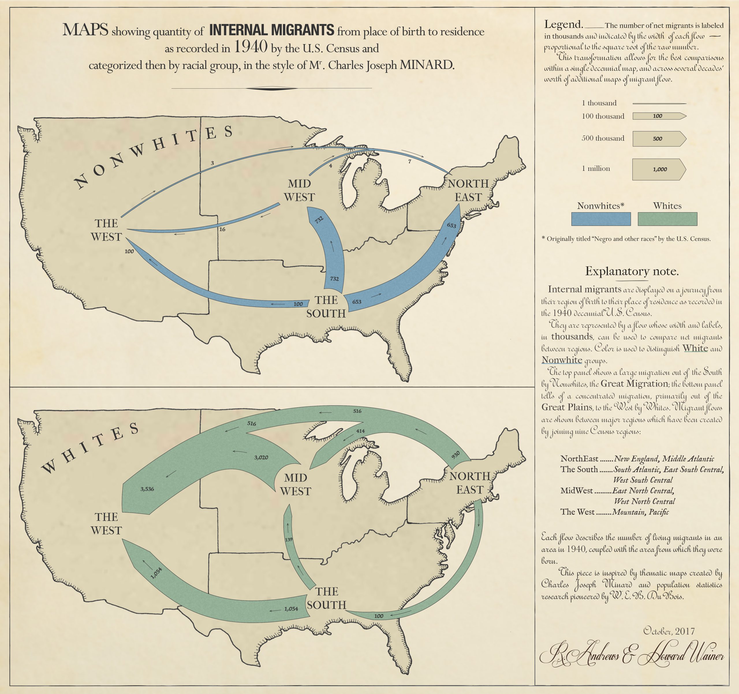
ABOVE Maps by the authors showing the quantity of internal migrants by birthplace and place of residence, as recorded by the 1940 US Census, categorised by racial group.


